Seychelles protecting even more of its waters, minister says on World Environment Day
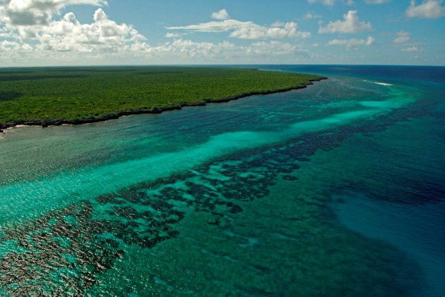
The first marine protected area included the waters surrounding the extremely isolated Aldabra Atoll. (Seychelles Island Foundation)
 Send to Kindle
(Seychelles News Agency) - Seychelles has designated 26 percent of its territorial waters as marine protection areas to complete the second phase of the debt for conservation finance deal with The Nature Conservancy, the environment minister said on Wednesday.
The announcement was made by Wallace Cosgrow, the Minister of Environment, Energy and Climate Change, in his message for the World Environment Day on June 5.
With the new designation, which is a product of the Marine Spatial Planning (MSP) process, Seychelles' protected area is now 350,915 square kilometres of the island nation’s Exclusive Economic Zone (EEZ) of 1.4 million square kilometres.
In February last year, the island nation announced two new Marine Protected Areas covering 210,000 square kilometre as part of the ground-breaking debt-for-conservation deal designed by The Nature Conservancy.
As part of the debt conversion, Seychelles is committed to increasing the marine protection area of its ocean from 0.04 percent to 30 percent as a groundbreaking debt refinancing. These first designations -- an area the size of Great Britain -- represents just the first half of the 410,000 square kilometres that will be protected by 2022.
In his message, Cosgrow said, “Seychelles is committed to have 30 percent of its EEZ designated as a protected area and to develop a comprehensive Marine Spatial Plan (MSP) to ensure the long-term protection of its marine species.”
"The increase in the marine protected area will also “improve resiliency of its coastal ecosystems with a changing climate and to ensure economic opportunities for fisheries, tourism and other uses,” added Cosgrow.
The Minister legally designated the marine boundaries on April 12.
 |
| The Marine Spatial Plan showing the second Marine Protected Area which includes the Amirantes to Fortune Bank. (Salifa Karapetyan, Seychelles News Agency) Photo License: CC-BY |
In the first phase, the area which is now fully protected where human activities are restricted is the Aldabra group.
The second proposal was to expand and re-designate Amirantes to Fortune Bank Area from 136,753 square km to 173,468 square km -- from 10.1 to 13 percent.
In an interview with SNA last December, Helena Sims - the project manager of the plan – said that “there is a high level of agreement from stakeholders that the Amirantes to Fortune Bank area is important for the economic security of domestic fisheries and tourism, develop and enforce sustainability criteria for all fisheries, and increase enforcement of Illegal, unreported and unregulated fishing.”
Alphonse, Farquhar, as well as Denis and Bird Island, are among the areas which are also being considered for designation as marine protection areas.
The marine spatial plan is an on-going process through December 2020 to identify marine zones and allowable activities for all marine waters in Seychelles. The marine zones are gazetted at intervals during the process as per conditions of the debt swap.


