3D technologies used for the first time to map Seychelles’ Fregate island marine habitats
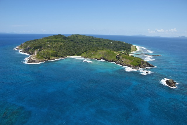
Fregate Island already has its own partners passionate in ocean and protection of marine biodiversity. (Gerard Larose, Seychelles Tourism Board)
 Send to Kindle
(Seychelles News Agency) - The Green Islands Foundation (GIF) has started to map the marine habitats around Fregate Island using 3D technologies.
State of the art technologies, such as 3D virtual reef mosaics, will be used to raise public awareness of the threats facing coral reefs and marine conservation.
This is the first such exercise to take place in the area and the first Seychelles Blue Bond-funded project to kick off.
Having started in September, the foundation is working in collaboration with the BlueNomads.org Inc, Coralive.org, SeyCCAT, the University of Seychelles through the Blue Economy Research Institute (BERI) and Fregate Island Private to implement the two-year project.
GIF, a local non-for-profit organisation, signed an agreement with Fregate Island Private in 2018 to conduct an initial assessment of the coral reef assemblage and associated marine species.
Fregate Island already has its own partners passionate in ocean and protection of marine biodiversity, namely Coralive, a Swiss-based environmental organisation operating worldwide, and Blue Nomads based in the Philippines which specialises in cutting-edge technologies, bathymetry survey and ocean mapping.
Through the ‘Marine Biodiversity Baseline assessment around Fregate Island’, the team is also assessing trends over time by establishing a long-term marine monitoring program on Fregate Island.
Baseline biodiversity assessment data collection methods will be carried out in year one and repeated in year two from which conclusions of the assessment will be drawn.
Fregate is the easternmost of Seychelles' granitic Inner Islands, located 55 km east of the main island of Mahe.
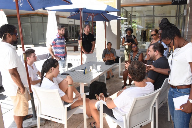
Talking to the press on Friday, the General Manager of the Foundation, Wilna Accouche, said she and her team are really excited and looking forward to this great collaboration, the main purpose of which is to know what are in the waters around Fregate Island, something which is totally unknown right now.
 |
| The team is also assessing trends over time by establishing a long-term marine monitoring program on Fregate Island. (Seychelles Nation) Photo License: CC-BY |
“For islands like Fregate, their main interest is tourism development and for it to welcome and support such a project, to also know what lies around it without any obligation, is really commendable,” said Accouche.
She added that the research has an educational aspect as the data collected will be made available to UniSey environmental science students and for other research purposes.
The projects amount to a total of $42,125, $29,670 of which is being funded by SeyCCAT, with co-financing coming from other partners, including Fregate Island Private. Twenty percent of the Seychelles Blue Bond worth $15 million is being managed by SeyCCAT.
The Seychelles Blue Bond - an initiative that combines public and private investment – is aimed at assisting the country in achieving a transition to sustainable fisheries and safeguarding its oceans while sustainably develop the blue economy.
Angelique Pouponneau, the chief executive of SeyCCAT said the project has attracted and brought together a remarkable number of partners and donors.
“SeyCCAT is very happy and proud as it is one of the first projects being supported and funded by Seychelles’ Blue Bond. It is the first time that high-level technologies will be used to undertake mapping of the seafloor of that area and we are really excited,” said Pouponneau.
Ahmad Allahgholi, the founder and director of Coralive, explained that the mapping will comprise a bathymetry scan to have a basic understanding of how the ocean floor around the island looks like. Ultra-high resolution digital images of what has been scanned will be produced and these images would be analysed using sophisticated technological systems.
“It is really a very easy and fast way to use technology and data to protect nature,” Allahgholi pointed out.
It is also expected that the outcome of such a project would advance better management of the waters around the island, enhance public awareness, and contribute to the 2020 vision contained in Seychelles’ Sustainable Development Strategy.


