New hydrographic survey data on Seychelles' ports give 50-year-old maps a modern makeover
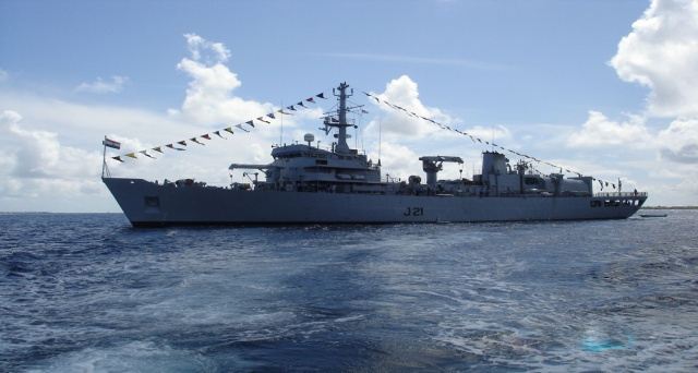
The surveys, including in the port area of Victoria, were carried out by the Indian Hydrography Ship INS Darshak. (Indian High Commission)
 Send to Kindle
(Seychelles News Agency) - Dredging work in Seychelles' Port Victoria can now be planned using highly accurate information after an electronic hydrographic survey data was handed over to the Ministry for Ports and Marine on Friday.
New survey data taken around the islands of Praslin and La Digue will allow officials to update maps that in some cases are nearly 50 years old.
The surveys, including in the port area of Victoria, the capital, were carried out by the Indian Hydrography Ship INS Darshak, under a Memorandum of Understanding between Seychelles and India.
The chief executive of the Seychelles Ports Authority, Ronny Brutus, told the press that the information has come at an opportune time.
"We have the Port Victoria extension which is already ongoing. We need this data to ascertain the extent of siltation within the port so that we know how much and where to dredge and what are the difficulties foreseen when construction works starts," said Brutus.
Hydrography is the science that measures and describes the physical features of bodies of water. Hydrographic surveys give information on the water level and tides, currents, temperature and salinity.
Brutus said the data "gives engineers greater information so that when they are doing the design, they know for certain that they are addressing actual issues."
Furthermore, there is a cost component with dredging and without accurate information "it will be difficult for us to know the exact scope of work which has a direct impact on our budget," he added.
The data will also provide mariners with accurate information about the navigational passages within the port. Aside from Port Victoria, hydrographic data was also collected around Praslin and La Digue, the second- and third-most populated islands of Seychelles.
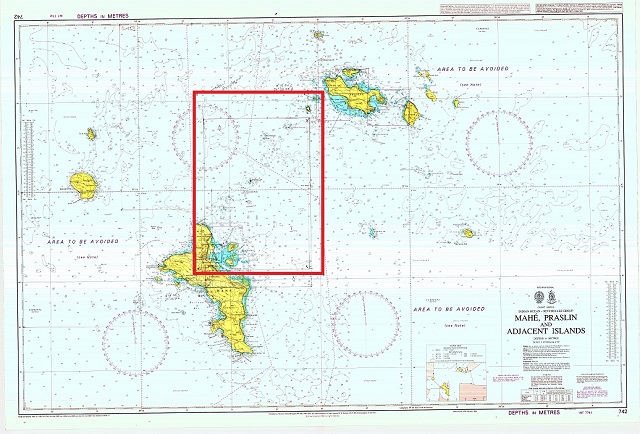 |
| The area marked in red is where the surveys were conducted. (Seychelles Maritime Safety Administration) Photo License: CC-BY |
The Principal Secretary for Civil Aviation, Ports and Marine, Alan Renaud, said that the data from Praslin and La Digue is also important as these are areas of high traffic.
"Some of our charts before this year dated 1971, and since then a lot has changed. If you look at the official maps around Praslin and La Digue, there where entire areas that says area to be avoided. This is because these areas had not been mapped, but now this has changed," said Renaud.
This is the first time that electronic charts have been put together for Seychelles, a group of 115 islands in the western Indian Ocean.
Renaud said that this is of an advantage as "today's modern ships have very sophisticated computerised systems and there are a lot of reasons why we are moving to the technology."
This includes reducing the number of physical forms that are used and another is to keep changing physical charts when there is an update.
"However when it is electronic, it becomes easier where you can just download and update it when coming to a port using Wi-Fi. We are graduating from analogue charts to electronic data, in line with the advances of technology around the world and this is part of the modernisation of the port," said Renaud.
All of the collected data from under the sea is part of the Seychelles' marine spatial intelligence, having incredible value and contributing to the country's economy.
Renaud explained that these charts are sold to ships and vessels coming into Port Victoria are required to have the latest version.


